There is a bend in the road between Quiroga and O Courel, at kilometre nine of the LU-651, where the mountain across the valley has been peeled open like the page of a book held too close to a flame. The rock does not lie in flat beds the way rock is supposed to. It curls. A whole flank of the Serra do Courel bends back on itself in a single clean arc, the strata bowing through ninety degrees and lying down almost horizontal, as if the mountain had been gripped at both ends and folded by a hand the size of a continent. It was. The hand was Pangaea assembling itself.
This is the Campodola-Leixazós syncline, and it is the reason the entire territory exists in the shape it does. Most recumbent folds of this scale are buried, inferred from boreholes and seismic lines by geologists who will never set eyes on them. This one surfaced. Erosion stripped away everything that should have hidden it and left the structure exposed across a stretch of valley you can take in from a single roadside viewpoint. It has been recognised as a geological site of international rank since 1983, and declared a Natural Monument in 2012. For a certain kind of traveller it is the headline act of Galicia. For almost everyone else passing through on the way to a vineyard, it is a pretty hillside they do not stop for.
The Floor Beneath the Story
Ribeira Sacra is understood, almost without exception, through two things: the Romanesque churches scattered across its parishes, and the wine pulled from its terraces. Both are real and both are worth the journey. But both are recent. The churches are nine centuries old; the terraces, where they are not Roman, are medieval. Underneath them runs a layer that makes the human ones look like a film of dust on a stone floor.
The quartzites and slates that fold through Campodola were laid down in the Ordovician, some four hundred and seventy million years ago, when the land that is now Galicia sat near the equator on the edge of a vanished ocean. They were squeezed into their impossible shapes much later, between roughly three hundred and twenty-four and three hundred and five million years ago, in the slow collision of Gondwana and Laurasia that raised the supercontinent of Pangaea and built the Iberian Massif on which all of modern Galicia rests. Geologists call Campodola the kilometre zero of that orogeny — the one place where the event that made the ground itself can be seen, plainly, with the naked eye. The canyon the Sil later carved, the schist that warms the south-facing vines, the very steepness that forced viticulture into terraces: all of it is the surface expression of that buried architecture. The wine is an argument the rock started.
The Gold That Moved a River
The Romans understood the rock better than the brochures do. They came to this corner of the empire for one reason, and it was not the landscape. It was gold, and the Sil carried it.
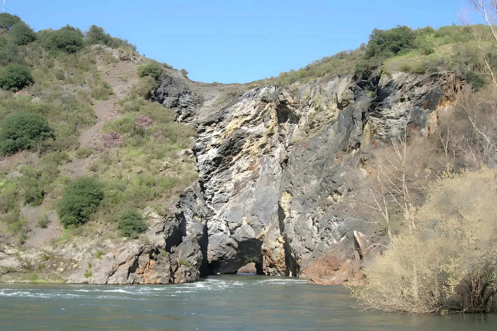
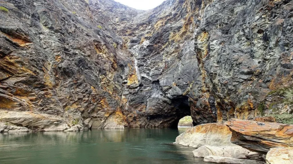
A few kilometres downstream from Quiroga, at Montefurado, the river once looped through a meander nearly two and a half kilometres long to get around a single hard wall of quartzite. The neck of that wall was only a hundred and forty metres across. In the second century, with no explosives and nothing but iron, fire and an empire’s worth of forced labour, Roman engineers drove a tunnel straight through it, diverted the entire river, and left the meander’s gravel bed dry so it could be sieved for gold. The name says it plainly: monte furado, the pierced mountain. The tunnel is still there, still carrying the Sil, partly collapsed but unmistakably deliberate. Near the village above it, the hillsides show the same clay pinnacles that make Las Médulas in nearby León a World Heritage Site — the residue of ruina montium, the technique of undermining a slope with water until it falls apart in your hands.
What happened next is the detail that holds the whole territory in one image. When the gold ran out and the Romans left, the people who stayed found the abandoned mine galleries cool, dark and dry, and turned them into wine cellars. The tunnels cut for gold became bodegas for mencía. Two thousand years of the territory’s logic — extract, exhaust, repurpose, endure — compressed into a single hole in the rock.
An Eastern Ribeira Sacra
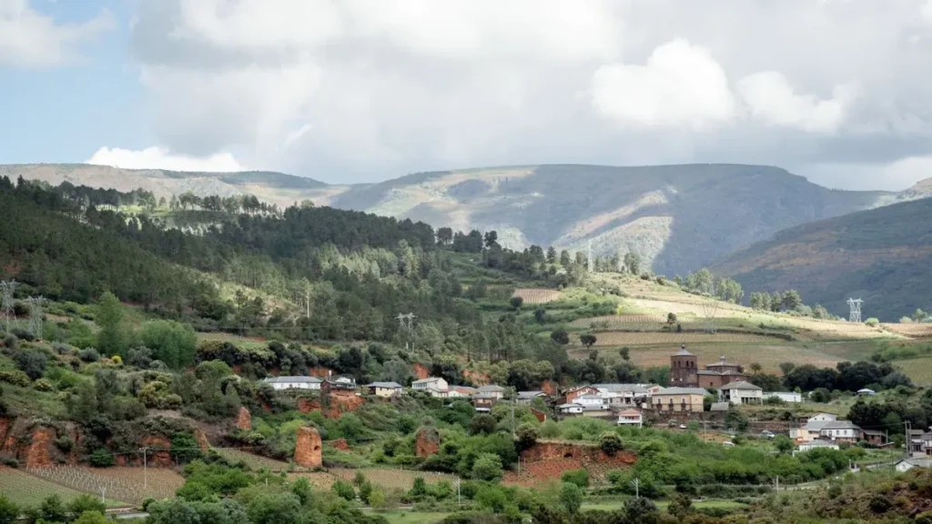
It is worth being honest about where this all sits, because it is not where the postcards are. This is the far eastern, inland edge of the territory — the dry, high, Mediterranean-tinged Ribeira Sacra of the upper Sil, around Quiroga and O Courel, not the misted canyon of the catamaran photographs. Much of it falls within the Montañas do Courel UNESCO Global Geopark, though the label, as the territory’s tangle of overlapping designations tends to, describes the rock more than it protects it. A working slate quarry sits a couple of kilometres from the protected fold, and slate is still what pays the wages in Quiroga. The point of the Geopark is not the seal. It is that someone, at last, decided the stone was worth explaining.
There are two places where that explaining is already done. The Museo Xeolóxico de Quiroga — the first museum in Galicia given over entirely to geological heritage, five small rooms arranged from oldest to youngest — exists to hand you the grammar before you go looking for the sentences. Its companion, the C.I.M.A.R. at Ribas de Sil, does the same for Montefurado. Both keep limited rural hours and are worth a call ahead; visit them and then drive out to the fold and the tunnel — a route we’ve laid out over two unhurried days — and the territory rearranges itself in front of you: not a landscape with some old churches in it, but the thin, recent, human skin on something vast and patient and still moving, a millimetre a million years, under the vines.
That is the quiet proposition of the geological Ribeira Sacra. It does not compete with the wine or the Romanesque; it underwrites them. The same collision that folded Campodola raised the hills the monks withdrew into and tilted the slopes the growers learned to terrace. The gold that drew the Romans is the reason there were galleries to turn into cellars. Everything the territory is now stands on something it did not choose and cannot see. The rock waited five hundred million years to be noticed. It can wait a little longer, while the rest of us catch up to the idea that the oldest thing here might also be the most overlooked.
The Roman tunnel at Montefurado, Quiroga, Lugo — photo by J. A. Gil Martínez, edited with AI.
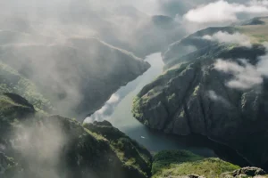
Inside the Montefurado gorge, Quiroga, Lugo — photo by M. Piñeiro, edited with AI.
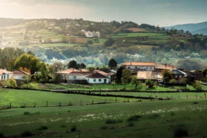
Montefurado village, built on the old mine workings — photo by AgaKu, edited with AI.