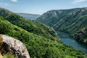
The vines that everyone comes for are a thousand years old. The stone they grow on is half a billion. This is the drive that goes past the wine to the two oldest stories in the territory — the gold the Romans tore out of the Sil, and the rock that put it there — and it asks for two days rather than one, not because the kilometres are hard but because the subjects don’t share a register. One belongs to the river and the work done on it; the other belongs to the sierra and to time so deep the river is a recent guest. Quiroga sits on the seam between them, and the country comes apart cleanly along it — two halves, each with its own weather and its own argument.
The first half follows the gold downstream, and it should begin under a roof.
DAY 1 · THE GOLD
~18 km drive · 3 stops · 3–6 hours · Start: Ribas de Sil · End: Montefurado, Quiroga
Start at the C.I.M.A.R. in San Clodio, the first museum in Galicia given over entirely to Roman gold mining, set almost on the gravel of the Sil beside the geocamping. The thing to grasp here, before going out to meet it in daylight, is the method: ruina montium, the deliberate collapse of a mountainside by stored water released under its own weight — the same technique that hollowed out Las Médulas. The valley you drive into afterwards is the long aftermath of exactly that violence, two thousand years of green grown over an industrial wound.
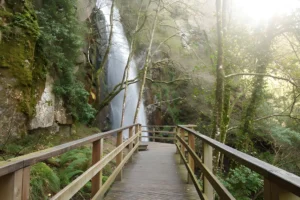
From San Clodio the road runs south to the wound itself. The Túnel de Montefurado is neither cave nor accident: in the second century, under Trajan, Roman engineers cut a passage clean through the quartzite ridge of the Pena do Corvo to throw the Sil off its course and work the gold-bearing gravels of the abandoned meander. The bore they drove ran perhaps a hundred and twenty metres. A catastrophic flood in 1934 brought down more than half of it, and what stands today is closer to fifty — a number that keeps falling, because the river still rises and the rock still gives. Only last winter a team from Salamanca and the Sil basin authority returned with drones and ground tomography to build a digital model of why the mountain keeps failing. The monument is, quite literally, still moving.
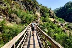
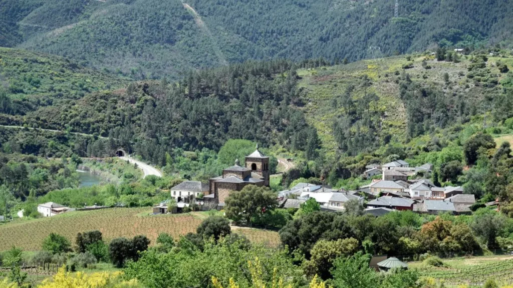
The viewpoint above it was reworked recently — railings, panel, the path down to the water all put right — so the approach is sound and the framing generous. Park at the signposted aparcadoiro, take the Anguieiros mirador for the arch, then drop the short way into Montefurado village. The houses wear the colour of the hill for a reason: the red mortar is the same washed earth the Romans turned for gold, and the clay pinnacles standing over the rooftops are the after-image of the digging — though the two tallest are honest about their age, raised in the 1970s when soil was hauled out to bank up the N-120. Extraction, exhaustion, reuse, endurance: the whole grammar of this territory pressed into one small reddish village with a hole in the mountain at its back. Walkers who want the gold underfoot rather than under glass can take the Covallón circuit — a 5.5 km loop from Louxadelas, up the flank of Monte Cerengo past four Roman workings, a steady climb and properly waymarked, mapped on Wikiloc for anyone who wants it.
The second half leaves the river entirely, and trades distance for depth.
DAY 2 · THE ROCK
~9 km drive · 2 stops · 2–3 hours · Start: Quiroga · End: Campodola-Leixazós fold
Begin in Quiroga town at the Museo Xeolóxico, five small rooms that lay six hundred million years out in the order the rock itself stacked them. The opening room is the fold you’ll go and stand before later, which is the right way round — Campodola rewards a little preparation. Entry is a single euro, and the staff read the local stone the way other places read their saints.
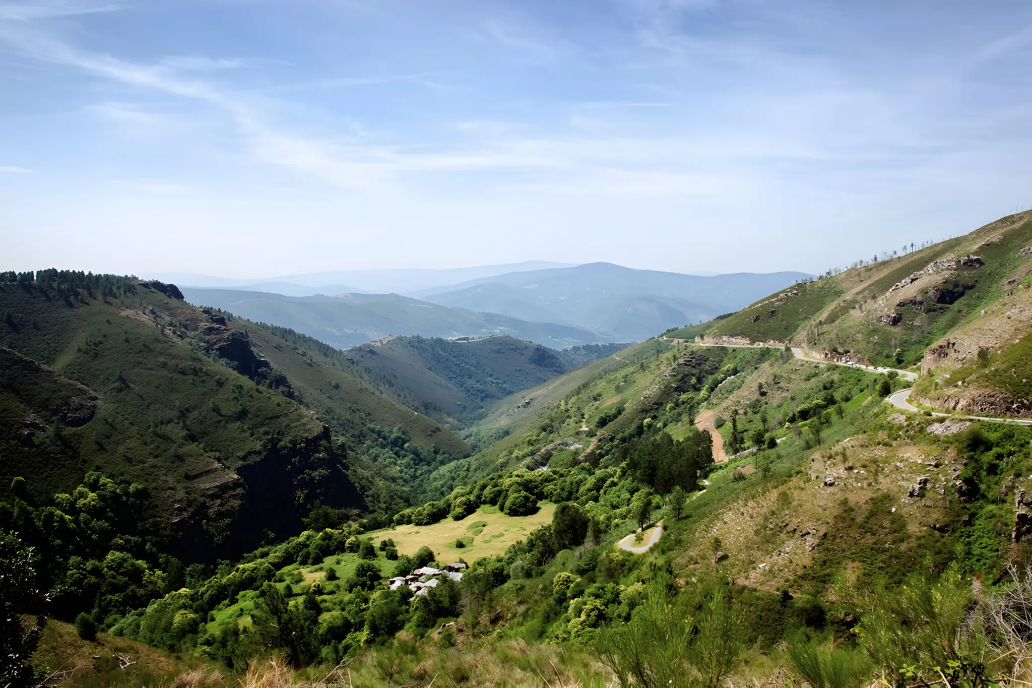
The day’s fixed point, though, is north. Take the LU-651 to Campodola, where a fold the size of a hillside lies on its side in plain view from the tarmac. This is a sinclinal tumbado, a syncline tipped over and laid flat during the Variscan collision that welded the Iberian Massif some three hundred million years ago — and it is readable with the naked eye as almost no geology ever is, the strata curling back on themselves like grain in split timber. It was recognised internationally as a reference fold in 1983 and declared a Natural Monument in 2012. There is a roadside viewpoint with a panel; nothing to book, nothing to pay. You stand where the road allows and read three hundred million years off a slope.
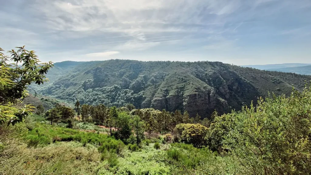
Three minutes further up the same road, the Miradoiro Ecoparque do Courel opens a different argument entirely. Where Campodola is one fold read close, this is the long view out over the whole of it — the Geopark’s own balcony, the point where the eastern Ribeira Sacra stops being a single monument and becomes a territory you could spend a week inside. It belongs to a separate trip, into the Courel proper, but it sits close enough to the fold to mark the threshold. One viewpoint never gives you the whole structure, though, and the fold is better understood from inside it than from any single turnout: the trail from Campodola to Leixazós runs along its own length, about an hour and a half, and it’s the only way to watch the strata shift as you move rather than from one fixed frame.
The museums are the one variable that decides the rhythm of both days. Each keeps short, shifting hours — a couple of midday windows, weekends only at the C.I.M.A.R. — and each is happiest with a phone call ahead. Treat any posted timetable as a rumour and confirm it directly. Groups can usually arrange a visit outside the published window, which quietly dissolves the whole timing problem. Could it be done in a single day? With both museums confirmed and an early start, yes — roughly fifty-five kilometres with the two openings as fixed points to thread between. But it would mean eating in the car and standing at the fold no longer than it takes to look, with no room for the Covallón loop or the climb into the Courel that gives the second day its horizon. The territory has waited five hundred million years to be read. It will keep for a second afternoon — and the LU-651 itself, quiet, well-graded and short on traffic, is the kind of road that draws its own steady trickle of motorbikes on a clear weekend, with or without the fold as an excuse.
Geological fold of Campodola-Leixazós, Quiroga, Lugo — photo by P. Vanossi, edited with AI.
View of the Montefurado village, Quiroga, Lugo — photo by A. Estévez, edited with AI.