Most visitors come to Ribeira Sacra for the canyon. They drive to a viewpoint, look down at the river curving four hundred metres below, and decide the territory has been understood. The Romanesque churches scattered across these hillsides offer a different proposition. They ask for the inverse movement — not down into the spectacle, but laterally, into the parishes that built and maintained them for nine centuries.
There are more than a hundred Romanesque buildings inside what is now called Ribeira Sacra. The density has no real European equivalent — a function of monastic colonisation between the ninth and twelfth centuries, when Benedictine and later Cistercian houses organised the steep land into a working agricultural system. Each parish church anchored a productive cluster: vineyards on the slopes, chestnut groves on the upper terraces, water mills along the tributaries, a chapel at the centre to mark the days. The architecture is plain by the standards of cathedrals further north, but precise — local granite and schist, single naves, semicircular apses, restrained ornament around the doorways. What carries the weight is not the buildings in isolation but the network they form across the territory.
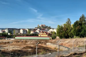
The regional tourism authority offers an official Romanesque route, beginning conventionally from Ourense and circling through thirteen churches and the monastery of Ferreira de Pantón. For visitors with three or four days and a completionist instinct, it remains the most thorough way to see the major examples in sequence. The published itinerary moves from Chantada south to Santo Estevo de Ribas de Miño, then either upstream to Pesqueiras and Portomarín or directly to San Paio de Diomondi and San Martiño da Cova, before crossing into the dense Pantón cluster — Eiré, Atán, Pombeiro, San Fiz, Ferreira — and finishing through the Sober parishes of Canaval, Proendos, Bolmente, Pinol and Lobios. A visitor already based inside the territory, in Monforte or Chantada, can shorten the loop by half. The Atán–Pombeiro segment runs more cleanly if Pombeiro is approached from Os Peares before doubling back through Atán toward Eiré, rather than after. These are practical adjustments, not corrections.
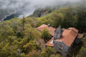
What the official route does not include is also worth knowing. The Sil canyon’s two great Romanesque monastic complexes — Santa Cristina de Ribas de Sil and Santo Estevo de Ribas de Sil — are routed separately as the Route of the Monasteries, an institutional distinction between parish churches and monastic foundations. Either is essential to any honest reading of Romanesque in this territory. Santa Cristina, embedded in chestnut forest below the Parada de Sil rim, holds the contemplative end of the tradition; Santo Estevo, restored into a parador and crowning the canyon, holds its institutional weight. Together they make clear that the Romanesque here was not only parochial. It was also, in the canyon, monumental.
What the parish Romanesque offers, alongside the long route, is a way into Ribeira Sacra in shorter form. Four day-trips, each anchored on a small cluster of churches, each opening a different part of the territory.
The Pantón cluster sits on the south-facing tongue of land between the Miño and the Sil and holds the densest single concentration of Romanesque in the region. Five churches and one monastery within a working agricultural municipality — San Miguel de Eiré, Santo Estevo de Atán, San Vicente de Pombeiro, San Fiz de Cangas, and the still-active Mosteiro das Bernardas de Ferreira. The churches are the reason to come; the parishes around them are why you stay longer than planned. Pantón is the part of Ribeira Sacra least adjusted to visitors, which is part of its current value.
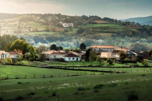
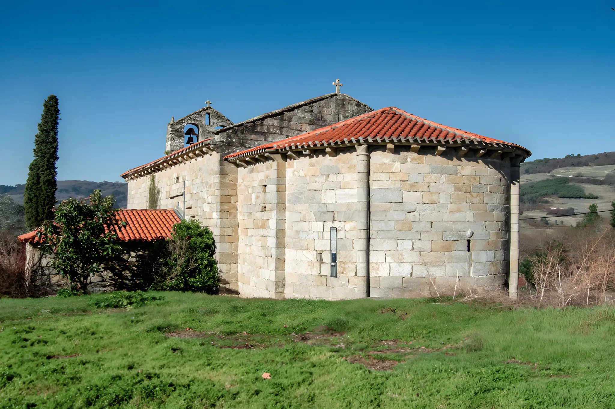
The Belesar crossing is where the Miño widens into the long reservoir between Chantada and O Saviñao. Here Romanesque sits directly above viticulture: Santa María de Pesqueiras, Santo Estevo de Ribas de Miño, San Paio de Diomondi, and San Martiño da Cova above the great meander of Cabo do Mundo. The architectural sequence reads as a single argument about how the church organised the slope, generation by generation. Beneath it runs the 1963 dam and what it drowned — thirty submerged villages, a thousand people displaced. The Romanesque is the visible layer; the drowned territory is the other.
Sober and the Amandi heartland places the churches inside Ribeira Sacra’s most important wine-producing zone. Three of them — Santa María de Proendos, San Vicente de Pinol and San Xulián de Lobios — preserve sixteenth-century mural paintings, two accessible through the Consorcio de Turismo’s pilot opening programme. The route also works as the most direct way into the productive geography behind the Amandi brand.
Taboada inland sits on the upper Miño bank in Lugo province, outside the canyon postcard altogether. Its Romanesque is parish-scale and modest in ambition but architecturally interesting — San Pedro de Bembibre, Santa María de Taboada dos Freires, Santa María de Piñeira and several others within a small radius. The municipality is rarely visited by foreign travellers and barely promoted, which gives any route through it a quality the busier zones can’t offer.
Four routes, then, each anchored on stones worth slowing down for. The full route is the long option for those who want it all. The day-trips are the shorter form for those who would rather spend their time in Pantón, Sober, or above Belesar, than in the car.
Igrexa de San Martiño da Cova, O Saviñao — photo by J. A. Gil Martínez, edited with AI.