Drive into Quiroga from the south and the territory introduces itself in acronyms. A brown sign welcomes you to the Montañas do Courel UNESCO Global Geopark. A few kilometres on, another announces the Ribeira Sacra e Serras do Oribio e Courel Biosphere Reserve. A third invites you to support the World Heritage candidature. Heroic viticulture branding fills in any remaining flat surfaces. Nothing has been inscribed on the World Heritage List, exactly. Nothing has been refused, exactly. The territory simply behaves as if a decision has already been made.
The labels refer to entirely different systems. The Geopark, recognised in 2019, is a geological-education framework — it interprets a landscape, it does not protect it. The Biosphere Reserve, designated in 2021 and covering 306,535 hectares across 23 municipalities, is an ecological-planning instrument administered by UNESCO’s Man and the Biosphere programme; most residents would struggle to draw its outline. The World Heritage bid is the one that carries the political weight. The 2021 file was withdrawn before ICOMOS could formally recommend against it; the current version, rebranded as Ribeira Sacra Waterscape, is queued for examination in the 2026 cycle. Three systems, three timelines, one increasingly framed territory.
What the Geopark Has Already Done
The Geopark is the only one of the three that has had time to produce visible effects. There are new interpretation centres, expanded waymarking, geological reading materials translated into multiple languages, and a steady supply of school groups in Folgoso do Courel learning that the slate underfoot is, in places, 500 million years old. There is also institutional funding visibility, which matters more than the brochures suggest — once a territory becomes a UNESCO node, it acquires a vocabulary for talking to the EU. Project lines open. Consultants appear.
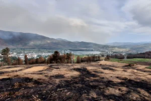
What the Geopark has not done is reverse the conditions that made the recognition available in the first place. Folgoso do Courel has lost roughly a third of its population in two decades. Quiroga’s median age keeps climbing. The 2022 wildfires burned through the Geopark’s most photographed valleys without consulting its zoning maps. None of this is the Geopark’s fault — it was never designed to halt rural decline. It was designed to make geology legible. It has done that.
The Sign Before the Thing
The more interesting question is what kind of infrastructure international recognition actually is. The signs are real; the funding lines are real; the buses of geological-tourism students are real. But recognition operates on the image of the territory before it operates on its substance. A UNESCO label changes how a place is described before it changes how a place is lived. For visitors this is sufficient — they came for the description. For the people staying through February it is a thinner offer.
This is where the two camps emerge, though “camps” overstates it. There is no public quarrel; there are two coexisting expectations. Rural accommodation owners, younger returnees, and the municipal offices treat UNESCO recognition as overdue economic leverage, and they are not wrong. Some vineyard owners, forestry operators, and longer-term residents look at the same recognition and see a future in which the territory becomes more valuable as landscape image than as lived economy. They are also not wrong. The bid’s most thoughtful sceptics are not against tourism; they are against the museumification that arrives quietly behind it.
A Heritage Built on Engineering
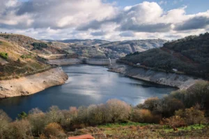
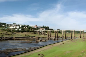
The contradiction is already visible in the landscape itself. The rivers now framed as Waterscape in the candidature title are heavily engineered hydroelectric systems. The Belesar dam (1963) and the Os Peares and Santo Estevo impoundments transformed valleys, submerged more than thirty settlements, and reorganised the river’s relationship to the people living above it. Further east, debates over wind farms on the high ridges of O Courel surface the next version of the same question: whether a territory can simultaneously function as protected heritage, working rural economy, and energy-producing landscape — and which of those roles eventually wins when they disagree.
None of this is an argument against the bid. The Waterscape framing is, in its way, the most honest the candidature has produced — it acknowledges that the cultural value of the territory is inseparable from how water has been used here, including industrially. It is also a framing that requires the territory to keep being inhabited, not just recognised. That part is not in UNESCO’s gift.
The View From the Viewpoint
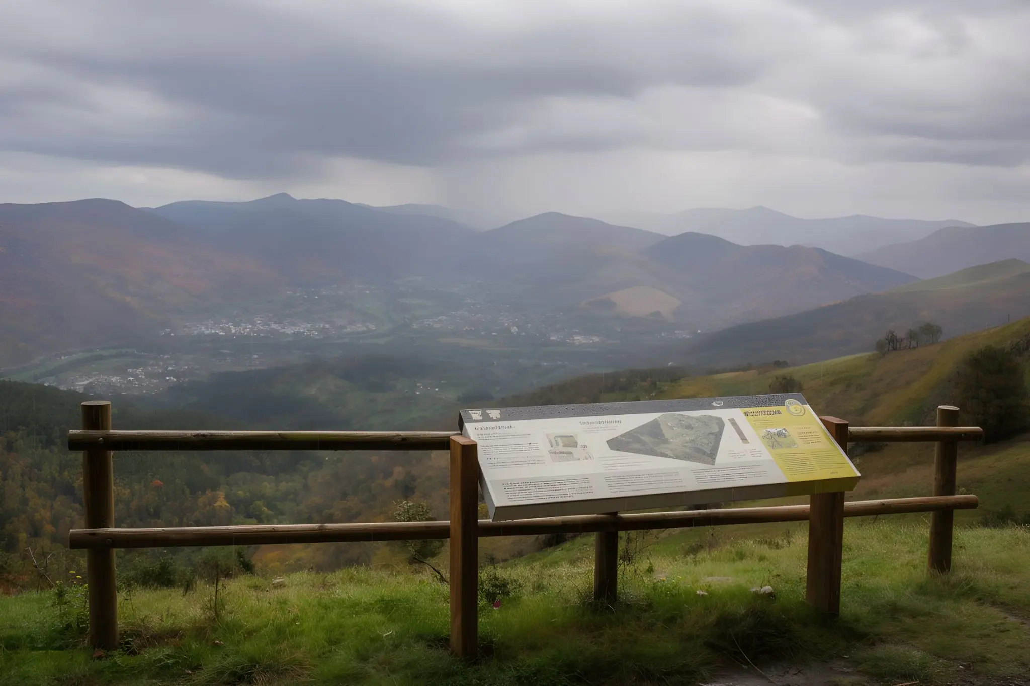
At one of the Geopark’s interpretive miradoiros above the Lor valley, a panel explains 500 million years of tectonic activity in four languages. Below, on the slope it describes, two of the four hamlets visible are functionally empty. The panel is accurate. So is the slope. International recognition has so far been better at preserving the territory’s image than its continuity, and the 2026 decision will not change which of those problems is harder.