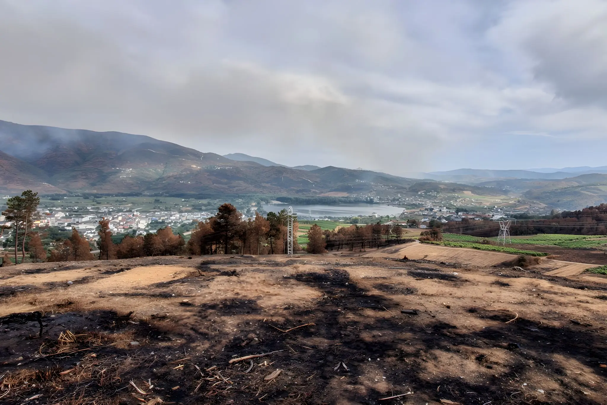
By the second week of August 2025, the smoke over inland Galicia had stopped looking like an event. It was light, weather, a tone of air. People kept the windows shut, checked the regional 112 alerts, sent each other photographs of the same orange sun. The Larouco fire, which would become the largest single wildfire ever recorded in Galicia, had been burning for several days before most people outside Ourense and Lugo paid much attention. By the time it crossed the Sil — at fifteen separate points, the Consellería de Medio Rural later said, “explosively” — it had become harder to ignore. By the time it reached Quiroga, it had become part of the territory.
The number that travelled was 30,000 hectares. The number that matters more, locally, is around 6,000 hectares burned inside the Quiroga-Bibei subzone of Ribeira Sacra: homes destroyed in Ferreira, in Albaredos, in Vilar de Mondelos; Alvaredos-Hobbs losing seventy to eighty per cent of its production and cancelling the 2025 vintage outright for smoke taint. These are the facts. The article that ends with them is the disaster article, and it has been written.
The Calendar That Replaced the Anomaly
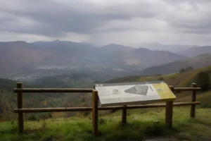
The more useful piece begins earlier and ends later. Galicia’s fire problem is structural, not meteorological, and the territory makes this unusually legible because its geography keeps the variables visibly apart. A vineyard slope at Doade, an abandoned terrace below Castro Caldelas, a eucalyptus stand on the road to Monforte, a chestnut grove above Parada de Sil — these are not landscape features. They are different states of human attention. Fire reads them like a diagnostic.
Inland Galicia burns now on a calendar. From June to October the smoke haze, the road closures, the WhatsApp alerts and the helicopters arrive as a season rather than a crisis. 2017 normalised the expectation across the region; 2022, with 11,000 hectares burned in Folgoso do Courel next door to Quiroga, confirmed it; 2025 raised the ceiling. The honest framing is not catastrophe; it is rhythm. The point is what the rhythm reveals.
A Geography That Stopped Being Worked
Where Ribeira Sacra still functions economically, fire slows down. Maintained vineyards on the Amandi schist, grazed parcels in Pantón, chestnut soutos cleaned for the autumn harvest, hamlets where someone still opens the door — these landscapes carry built-in interruptions. The mosaic is the by-product of the work. Where the work has stopped, the mosaic flattens: terraces collapse into scrub, soutos thicken, paths close, eucalyptus drops bark and oil onto a vegetation layer nothing now grazes. What remains is not a forest. It is fuel, in continuous sheets. Fire follows it the way water follows a slope.
This is the part that resists the climate-only narrative without denying it. The August 2025 heatwave was the longest on record and the European attribution studies have done their honest accounting. But the same dry summer would have burned differently on a worked landscape. Climate explains the conditions. Land use explains the spread.
The Eucalyptus Question, Stated Carefully
Eucalyptus deserves more than the reflex it usually gets. The species ignites fast, burns hot, sheds combustible litter, and recovers quickly enough to resist replacement. None of this is in dispute. But the problem in Ribeira Sacra is rarely a eucalyptus plantation alone — it is eucalyptus inside an unmaintained mosaic, beside abandoned terraces, against scrub that has had thirty years to settle in. Removing the tree without restoring the system around it solves nothing. The species is a symptom that has become structural.
Bureaucracy Replacing Daily Life
The Xunta’s prevention infrastructure is now visible everywhere in the form of the franxas secundarias de xestión de biomasa — the fifty-metre strips around inhabited zones, infrastructure and roads where pyrophyte species (pine, eucalyptus, acacia, mimosa) are prohibited and undergrowth must be cleared annually before 31 May. The framework is Lei 3/2007, tightened after the 2017 fires; the enforcement, after 2018, became real. Notifications arrive by post. SEAGA performs subsidiary work and bills the owner. Inspections happen.
The intention is sound and the effect is uneven. What the regulation is attempting, at considerable bureaucratic cost, is to reproduce around villages and roads what daily rural life used to produce around itself for free. When people lived in the aldea year-round, when goats and sheep grazed the woodland edge, when the path to the spring was walked weekly, when the chestnut grove was cleaned for the harvest — the mosaic was the by-product. None of it was fire prevention; all of it prevented fire. The franxa is a perimeter drawn around an absence. It works, where it is enforced, but it works in proportion to how thoroughly it admits what is no longer there.
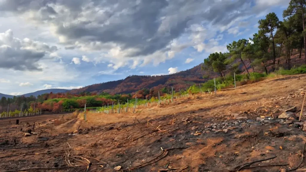
The Vineyard as Firebreak
The territory’s most labour-intensive land is also among its least combustible. A worked vineyard on a forty-degree slope is, incidentally, a firebreak: cleared rows, exposed schist, controlled biomass, somebody on the ground in August. The same is true of a maintained souto and a grazed meadow. The categories that marketing calls “heroic viticulture” are, viewed from a different angle, the territory’s working defence. Their economic fragility is the same fragility that makes the rest of the canyon burn.
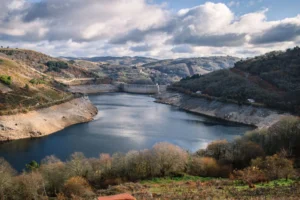
What the Canyon Does to a Fire
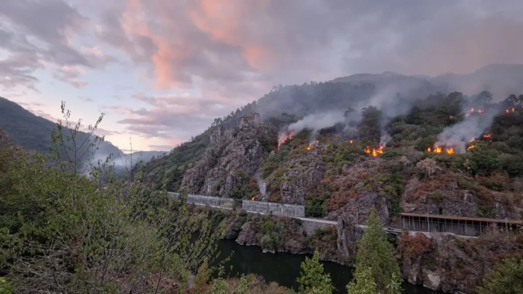
The geography that protected Ribeira Sacra historically now complicates suppression. Many canyon stretches are inaccessible to heavy machinery; air drops are difficult in narrow gorges with shifting winds; the same verticality that makes the territory visually unmistakable makes it operationally hostile in August. The Larouco fire behaved as a sixth-generation event — capable of generating its own weather, throwing embers across the river at fifteen separate points, advancing in ways that overran conventional suppression. The same canyons that the tourism campaigns photograph from above, the firefighters were trying to defend from below.
Green Returns Faster Than the System
Burned slopes in Ribeira Sacra rarely stay visually barren for long. Atlantic humidity and the speed of Galician vegetation can turn black hillsides green again within one to three years. The recovery is real, and it is misleading. Terrace walls collapse quietly under the new growth. Chestnut groves go unmanaged through a second winter. Paths disappear into the regrowth. Older owners look at the damaged parcel and decide it is not coming back. The vegetation returns faster than the landscape system that once shaped it — and what returns is not the mosaic, but its inverse.
What Fire Says, Exactly
Fire is not the story in Ribeira Sacra. It is the diagnostic. It reads, with unsentimental accuracy, where the territory is still being worked and where it has been quietly let go. The burned hectares of August 2025 are not a forecast of the territory’s future; they are a measurement of its present. Fire does not arrive randomly. It accelerates where the work has already stopped.
Above A Rúa; New vines; Active fire above the Sil — photos by P. Vanossi, edited with AI.