10.5 km circular · ~3 hours · easy–moderate · Start: Capela de Vilela, Taboada
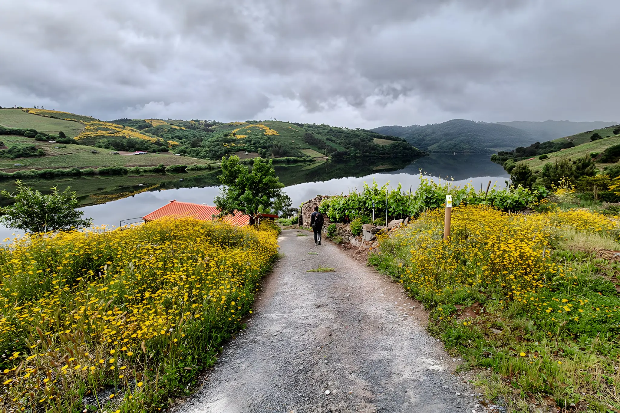
At this latitude the Miño has stopped behaving like a river. The cola of the Belesar reservoir reaches up into upper Pantón, and what runs below the path is wide, slow water. Vines climb both shores. Read from one bank to the other, they make a different kind of sense than the vertical terraces of the Sil or Amandi — lateral rather than vertical, two facing slopes rather than one drop. A Embelesadora arrives signposted as a sensory wellness path. The framing is worth stepping around. The walk’s actual subject is the river the dam left behind.
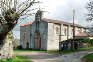
It begins at the church chapel of San Miguel de Vilela, a few minutes off the N-540 in the municipality of Taboada, southern Lugo province — a quiet, agricultural corner of the Miño bank that sits well outside the canyon-postcard circuit. The first half of the loop drops gently through the parishes of Vilela and Santiago de Sobrecedo toward the river: small hamlets, vegetable plots, stretches of oak and chestnut, occasional patches of pine and gorse. None of it is composed for the visitor. The path is the working tissue of two parishes, and it reads that way.
The descent reaches the Miño where it has been wide and slow since 1963 — this is the upper end of the Belesar reservoir, a stretch most travellers pass over by car between Chantada and Portomarín without registering. From the bank, on a clear day, you can see vines climbing both shores: the western terraces of Chantada subzone above you, the eastern slopes of O Saviñao opposite. They are, for once, easier to read sideways than from above. The canyon further south insists on vertigo; this is something else — bank viticulture at lower angles, where the river still behaves like a river rather than a corridor.
If the reservoir is low enough, you may see Castro Candaz, the pre-Roman fortified hill that sits across the water in the parish of Pedrafita, Chantada. It is normally underwater. Below roughly 25% reservoir capacity it surfaces — Roman-period origins, medieval reconstruction by the Taboada family, ruined in the fifteenth-century Irmandiño revolts, drowned in 1963 with everything else the Belesar dam took. Most years it stays submerged. The walk does not depend on seeing it, and treating its absence as the point — a sightline to a thing that is mostly not there — is closer to what this territory actually offers than any sensory checklist.
The return climbs steadily through the upper hamlets of Sobrecedo de Abaixo and Sobrecedo de Arriba, then down again past Rioseco and back to Vilela. About 350 metres of cumulative ascent over the full loop, well-spread, no severe gradient. The full circuit takes around three hours at a working pace, slightly more if you stop at the river — and stopping at the river is the only honest way to do it.
There is no parking near the chapel at San Miguel de Vilela; leave the car on the N-540 where the verge allows. There is no public transport to Vilela. Come in the morning if you want the light on the reservoir; come in long trousers regardless of season, because the section between A Laxa and Penedo da Cruz has not been maintained. Vegetation — nettles, wild rose, growth well above waist height — closes in on the path to the point of making progress genuinely unpleasant. The route is marked. That is the most that can be said for it in this stretch. Which makes the wellness branding something to file alongside the rest of what this walk refuses to deliver on schedule — and the reason it remains worth doing.