~11 km circular · ~3 hours · moderate · Start: Cima de Atán crossroads, Pantón
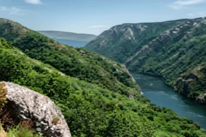
You hear the waterfall before you see it. From halfway down the descent, the Aguianza is already audible somewhere below the path — the only sound that breaks the route’s general quiet, which is otherwise the quiet of an embalsed river that has stopped behaving like a river. Above Cima de Atán the Miño sits wide and slow, slowed further by the Santo Estevo dam; the canyon’s working noise is downstream, the working vineyards are upstream, and the eleven-kilometre circular threaded through this stretch passes mostly through what is left in between — three river-facing hamlets, a Romanesque church, the densest cork-oak cover on the Lugo bank, and the small civic core of Marce, where a clock tower that once belonged to the Counts of Lemos still keeps parish time.
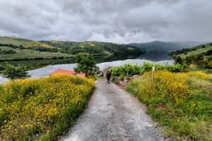
Start at the Cima de Atán crossroads, three small roads converging above the canyon. The first kilometre picks up the PR-G 162 — yellow-and-white waymarks, the path traced parallel to the Miño at roughly four hundred metres of elevation. Cork oaks appear quickly, first sign that this stretch of the gorge has its own microclimate. The river below is embalsed by the Santo Estevo dam, wider and stiller than the working Miño upstream. Reiriz, Seoane, Cabo de Vila: not abandoned, not restored. A vegetable garden, a fountain, someone working the slope.
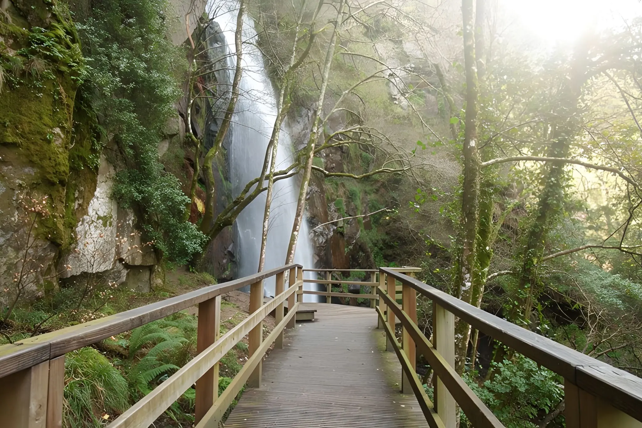
The descent to the Fervenza de Augacaída arrives at around the fifth kilometre. The waterfall drops more than forty metres in a single fall — one of the highest in Galicia and, until 2016, the route’s most dangerous segment. Wooden walkways and steps now handle the steepest hundred metres; that’s the only reason this loop is moderate rather than hard. Take the lower viewpoint, not just the upper. From the bottom you can read the geometry: the Aguianza cutting through schist on its way to the Miño two hundred metres below.
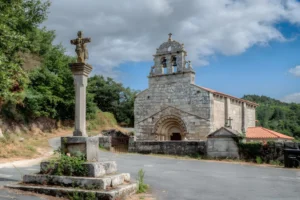
Back at the junction, turn for the Castro de Marce. The path narrows through the densest cork oaks of the route and arrives at a promontory 299 metres above the river. Pre-Roman fortified settlement; medieval stones on the lower slope point to later reuse, likely tied to the Lemos network that organised this parish. From the top: the Miño bending toward Os Peares to meet the Sil, and the Romanesque church of Chouzán on the opposite bank.
From the castro the trail climbs to O Quintairo, leaves the PR-G 162 for good, and drops into Marce — lavadero in working condition, the small Capilla de San Marcos, and the Torre do Reloxo, a relic of the Lemos lordship. Most people who walk to the waterfall never see this. Skipping it skips the human layer that holds the rest together.
The final three kilometres back to Cima de Atán run on the LU-P-4107 — quiet asphalt, oak-lined, light traffic. Walk it as the loop’s coda. Spring and autumn are the cleanest windows; in dry summer the fall thins, but cover holds nearly the full route. Park at Cima de Atán, not at the waterfall trailhead — the latter takes three cars at most. Bring water; the Marce fountain works most days, not all.