17.5 km circular · ~6 hours · moderate–hard · Start: Praza do Barquilleiro, Parada de Sil
Most walkers in Parada de Sil settle for the short descent to Santa Cristina or the rim balcony at A Mirada Máxica. The PR-G 98 does both — and a great deal more — in a single loop with two descents and two climbs. The compounding is the point. The canyon doesn’t reveal itself in a single gesture; it has to be earned twice.
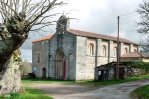
The route leaves Praza do Barquilleiro and drops first to the Monasterio de Santa Cristina de Ribas de Sil, threading through the souto — the chestnut forest that has its own ecology, its own light, and a few sequeiros (chestnut drying-houses) still standing along the path. Santa Cristina is encountered, not approached. The monastery emerges from the trees rather than from a viewpoint, which is exactly how its founders intended it: this was not architecture built to be seen.
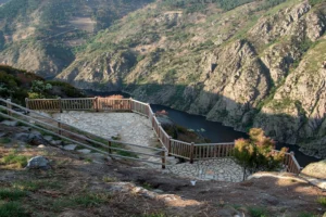
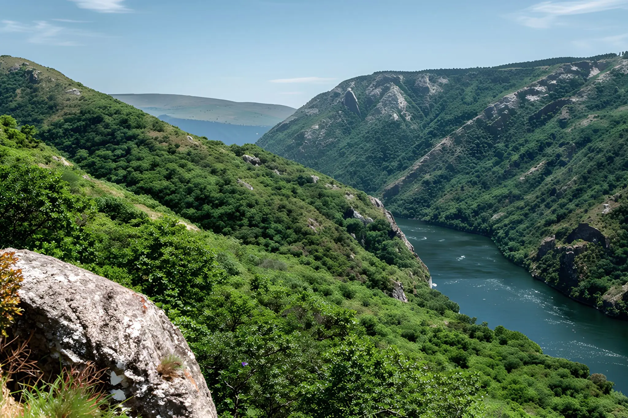
From Santa Cristina the route climbs back to the rim and then descends again, this time along the souto’s western flank, toward the Árbore Senlleira de Entrambosríos — a 700-year-old chestnut tree that the territory has decided to leave standing. This is where the walk separates itself from its lighter neighbours. Met from below, the Sil is climate rather than view: humid, vegetal, audible long before it is visible. The canyon stops being a thing you look at and becomes a thing you’re inside of.
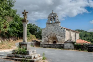
The second ascent returns to the plateau, and only now do the rim miradoiros appear — Mirador de Castro, A Mirada Máxica, the Balcones de Madrid named for the barquilleiros who left from these cliffs to sell wafers in the capital. Encountered after the canyon rather than before, the viewpoints function as punctuation rather than destination. You read them differently. The exposed depth below has weight because you’ve been at the bottom of it.
The route can also be divided into two rings — Ring 1 (~13 km, viewpoints and Santa Cristina) and Ring 2 (~8 km, Sardela and Entrambosríos) — and most walkers do one or the other. Doing them stitched together is what produces the route’s actual argument. They function as halves of a single sentence.
Practically: start early, especially in summer, because shade thins on the rim sections and the second climb is unforgiving in heat. Take more water than the distance suggests — there are no fountains on the route. Spring and autumn are best; the souto is at full colour in October. Mobile coverage drops in the canyon floor sections, so download the GPX in advance. The route doesn’t fit neatly into a half-day plan and shouldn’t be made to. It asks for the whole day, and gives the canyon back at full scale.