~9 km circular · 2.5–3 hours · easy–moderate · Start: Doade (Sober)
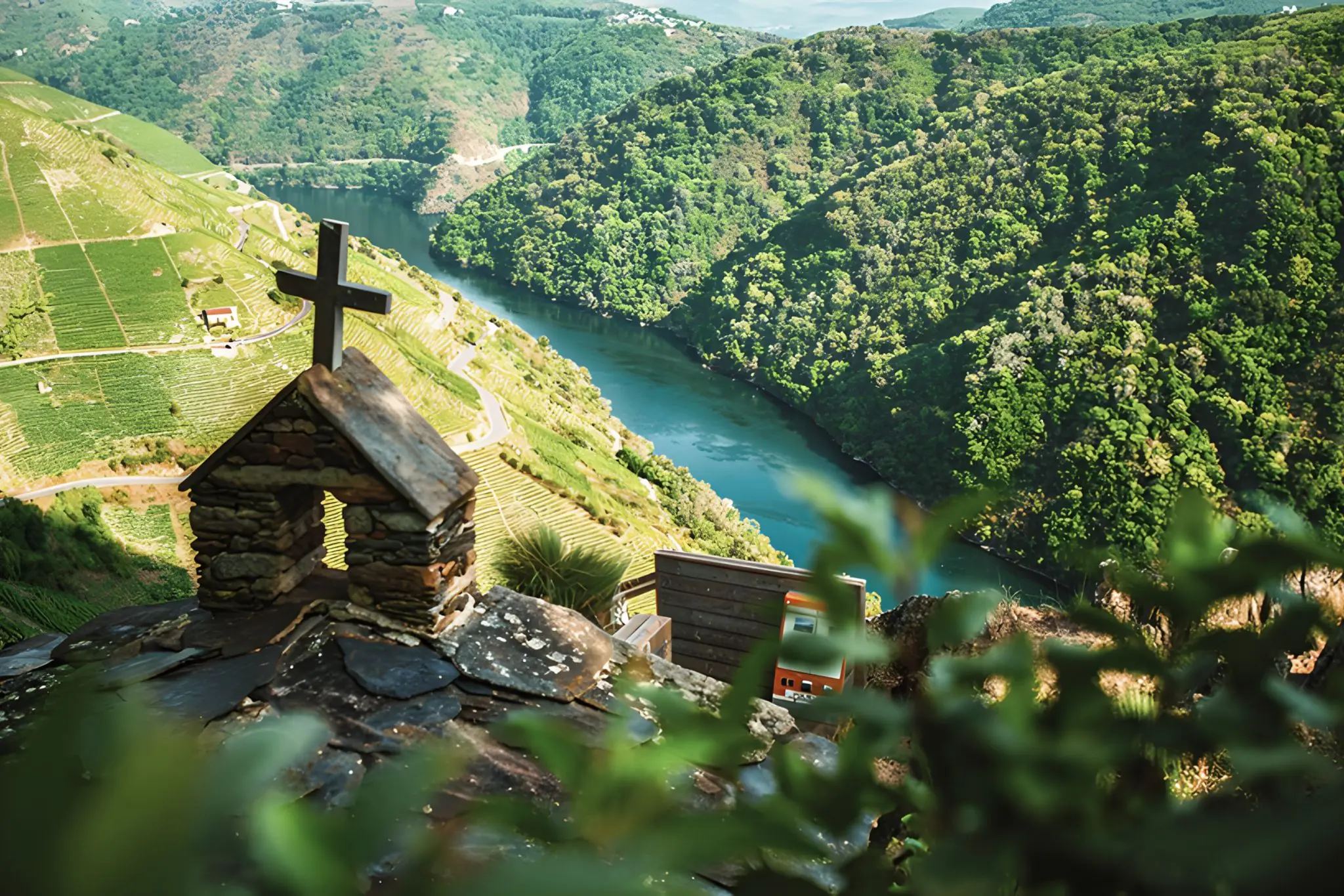
There’s a kind of walk that doesn’t announce itself. You leave Doade through the Souto de Valguaire, a grove of centenarian chestnuts, before the trail tilts. By the first kilometre, you reach Pena do Castelo — a small reconstructed chapel of San Mauro perched on what was once a castro, with 360° views into the canyon. The Sil sits three hundred metres below.
The miradoiros above Doade don’t arrive all at once. They accumulate. Each one reframes the same scene: the river bending south, the schist slopes catching or losing the light, the opposite bank stitched with terraces that look, from up here, impossibly tidy. From Pena do Castelo the path drops through the working vineyards themselves past Soutochao, where a granite sculpture called O Carreteiro shows a harvester with a basket of grapes balanced on his head. It’s the territory’s most material self-portrait.
This is the Amandi subzone at its most legible from the outside. The terracing below you isn’t scenery — it’s infrastructure, built to hold a gradient that tractors can’t work and abandonment keeps threatening. The schist soils retain heat into the evening, creating the warm, south-facing microclimate that defines the wines this slope produces. What you’re looking at, if you’re looking carefully, is the actual geometry of flavour.
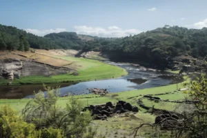
The path stays close to the working landscape rather than hovering above it. You hear things: machinery in the distance, a gate somewhere, the particular silence that follows. A steeper climb brings you to Mirador do Duque, looking down on the embarcadero where the catamarans leave for the river-level tour most visitors take instead. From up here you can see what they see, and what they don’t.
Late afternoon is the argument for this walk. As the sun drops west, the slopes across the river catch the light in a way that briefly makes everything look deliberate. Then it flattens into shadow and you walk back through Francos to Doade — quietly, without ceremony.
A word on the logistics: signage is uneven through the vineyard section — bring offline GPS. Carry water. Avoid the midday heat in summer. The circuit is closer to 9 km than the casual estimate, with real elevation gain.