A map of the Ribeira Sacra is a convincing object. It shows a bounded territory in southern Galicia, neatly contained between Lugo and Ourense, threaded by two rivers. It looks navigable. It looks, from a distance, like a single place.
It isn’t.
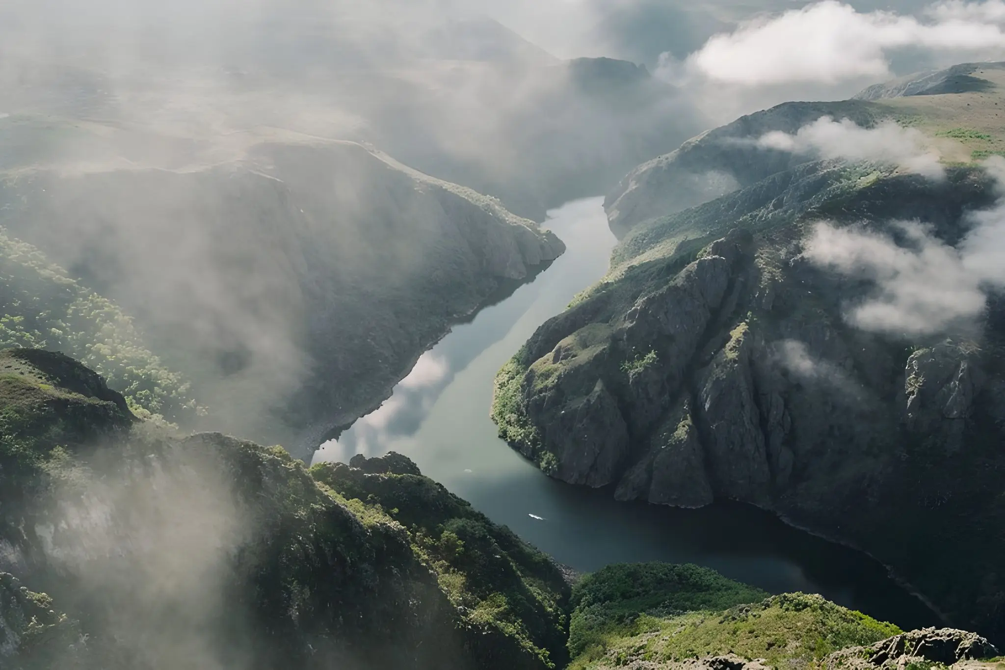
The Sil and the Miño don’t connect the territory — they cut it. Their gorges, in places over three hundred metres deep, are not scenic features to be appreciated from a viewpoint but physical interruptions that reorganise how you move, how long things take, and which world you’re in on any given morning. Crossing from one bank to the other means finding a bridge, and bridges here are rare and slow. Proximity on a map means very little. A village you can see from the opposite cliff may be forty minutes away by road.
This is the first thing to understand about the Ribeira Sacra: it is not one territory. It is several, held together by name and designation but separated by water and gradient and the particular logic each river valley has developed over centuries of relative isolation.
The Four Ribeiras
Chantada: The Territory Before the Canyon
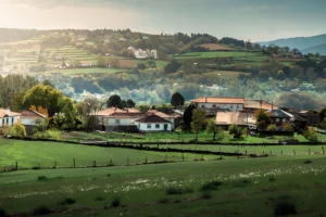
The eastern bank of the Miño is the Ribeira Sacra before it becomes spectacular. Chantada is its anchor — a working town, practical and untheatrical, with a market that still functions as a market rather than a lifestyle proposition. The landscape here is continuous and inhabited: rolling hills, old farmhouses, chestnut groves, vineyards on gentler slopes. Nothing announces itself. The drama has not yet arrived.
That absence is its character. The surrounding municipalities of Taboada and Carballedo extend the same quality — agricultural, lived-in, resistant to the vocabulary of spectacle. This is the Ribeira Sacra that most visitors skip, which means it’s the part that has changed the least. Those who stay here feel the slow rhythm of rural Galicia not as performance but as condition.
Ribeiras do Miño: Structure and Memory
Crossing to the western bank of the Miño is a shift in register. The landscape doesn’t become more dramatic — it becomes more loaded. This is the monastic corridor of the Ribeira Sacra: a sequence of foundations built along the river’s middle course that reflects centuries of territorial organisation imposed, first tentatively, then with confidence, by Benedictine and Cistercian communities.
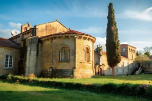
Ferreira de Pantón is the keystone of this zone — and, in some sense, of the whole territory. Its Cistercian convent has functioned without interruption since the twelfth century, which makes it exceptional not just in Ribeira Sacra but in Galicia. Pantón and O Saviñao extend the same logic: landscape that carries the visible weight of continuous occupation, where vine and cloister and village exist in a relationship that pre-dates the wine tourism it now partly hosts. The calm here is structural, not accidental.
Ribeiras do Sil: Vertical and Introspective
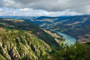
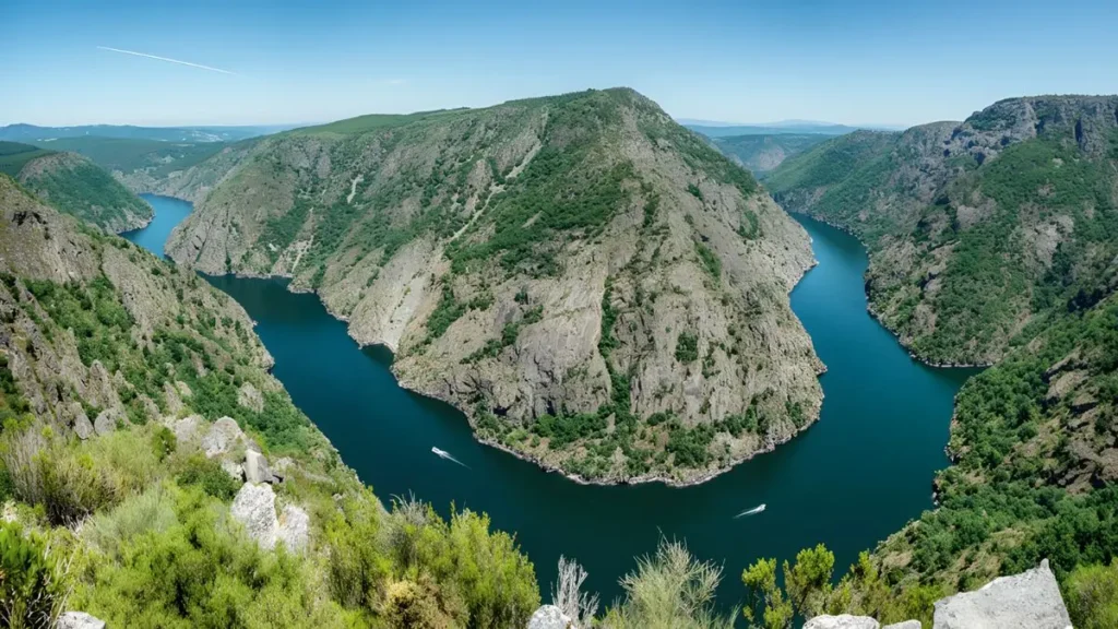
The Sil is a different proposition altogether. Its southern bank is where the Ribeira Sacra becomes the image that most people carry in their heads — the dramatic slate terraces descending to the river, the canyon walls, the miradoiros from which the full depth of the landscape reveals itself in a single, dizzying glance.
Parada de Sil is the entry point for much of this, and its surrounding territory holds the concentration of monastic sites that defines the Sil experience: withdrawn, embedded in the rock and forest, accessible only on the canyon’s terms. Nogueira de Ramuín — where the Parador de Santo Estevo anchors a very different kind of encounter with monastic architecture — marks the other pole. Between these two, the territory is vertical, introspective, and, for all its visual intensity, surprisingly difficult to access. The landscape here is not backdrop. It is the primary condition.
Amandi–Quiroga: Exposure and Transition
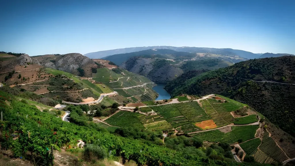
The northern bank of the Sil is the most internally contradictory of the four zones — and the most revealing because of it. Sober and its surrounding area hold the Amandi vineyards: the most iconic wine-producing landscape of the entire DO, terraced and sun-exposed in a way that concentrates everything the Sil valley has to offer in terms of solar intensity and drainage. Doade is the reference point, its viewpoint among the most replicated images in the region.
But the zone extends inland to Quiroga, and there the quality of light and land shifts perceptibly. The climate becomes drier, the terrain less vertical, the wine culture less visible. Monforte de Lemos — technically outside the Sil’s most dramatic section, but functioning as the logistical capital of the whole territory — holds the zone together more by gravity than by geography. What Amandi and Quiroga share is exposure: to sun, to the river, to transition. What they don’t always share is a sense of belonging to the same place.
Moving Within Fragments
The practical consequence of all this is that the Ribeira Sacra resists the logic of coverage. You don’t come here to see everything. Each crossing of a river is a decision, not a convenience, and most days naturally belong to one bank. A morning in the Amandi terraces is not compatible with an afternoon at Ferreira de Pantón — not because of the distance but because of the mental shift required. The territory demands a different kind of attention.
What the four-zone framework offers is not a tour itinerary but an honest structure: four distinct worlds, each worth entering on its own terms, each connected to the others by name and water and a shared stubbornness about remaining itself. Understanding the Ribeira Sacra doesn’t come from crossing it. It comes from staying long enough in one part of it to feel, eventually, the pull of the others.
San Martiño de Doade, Sober — photo by M. Piñeiro, edited with AI.
Sil River Canyon from the Vilouxe viewpoint — photo by Fernando, edited with AI.