13.5 km circular · ~4 hours · moderate–hard · Start: Castro de Abaixo, Ribas de Sil
Most people come to this corner of the Sil for the meander. The river doubles back on itself so tightly at A Cubela that it nearly closes a loop, and the photograph of that near-circle is what circulates. Walk the PR-G 180 and you find the meander was almost beside the point. The path is here because of gold, and what makes it worth walking is everything the gold left along it.
The loop begins at Castro de Abaixo, a hamlet hung above the N-120 near Augasmestas — the place where the Lor empties into the Sil, a meeting of waters that gives the spot its name. Take it clockwise: climb first, and save the riverside for the end, when your legs are done and the path is flat.
The ascent follows the old Camiño de Inverno, the winter branch of the Camino de Santiago that pilgrims used when snow shut the high passes. Before the pilgrims it carried something heavier: Castilian trade, and before that, the Roman traffic of an industrial valley. For the first four kilometres the path threads chestnut soutos, kitchen plots and small wet meadows the locals call lameiros, gaining height steadily until the trees open onto Torbeo.
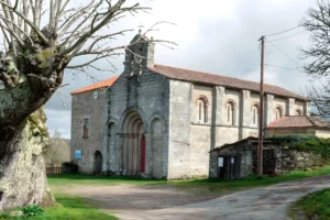
Step off the route here for a few minutes. The Romanesque church of Santa María de Torbeo (twelfth to thirteenth century) belonged to a Benedictine priory, and it sits in the village with the unannounced confidence of a building that has outlasted every institution that ever owned it. There is no ticket office and no fixed schedule; if the door is shut, the church is doing what it has always done.
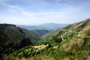
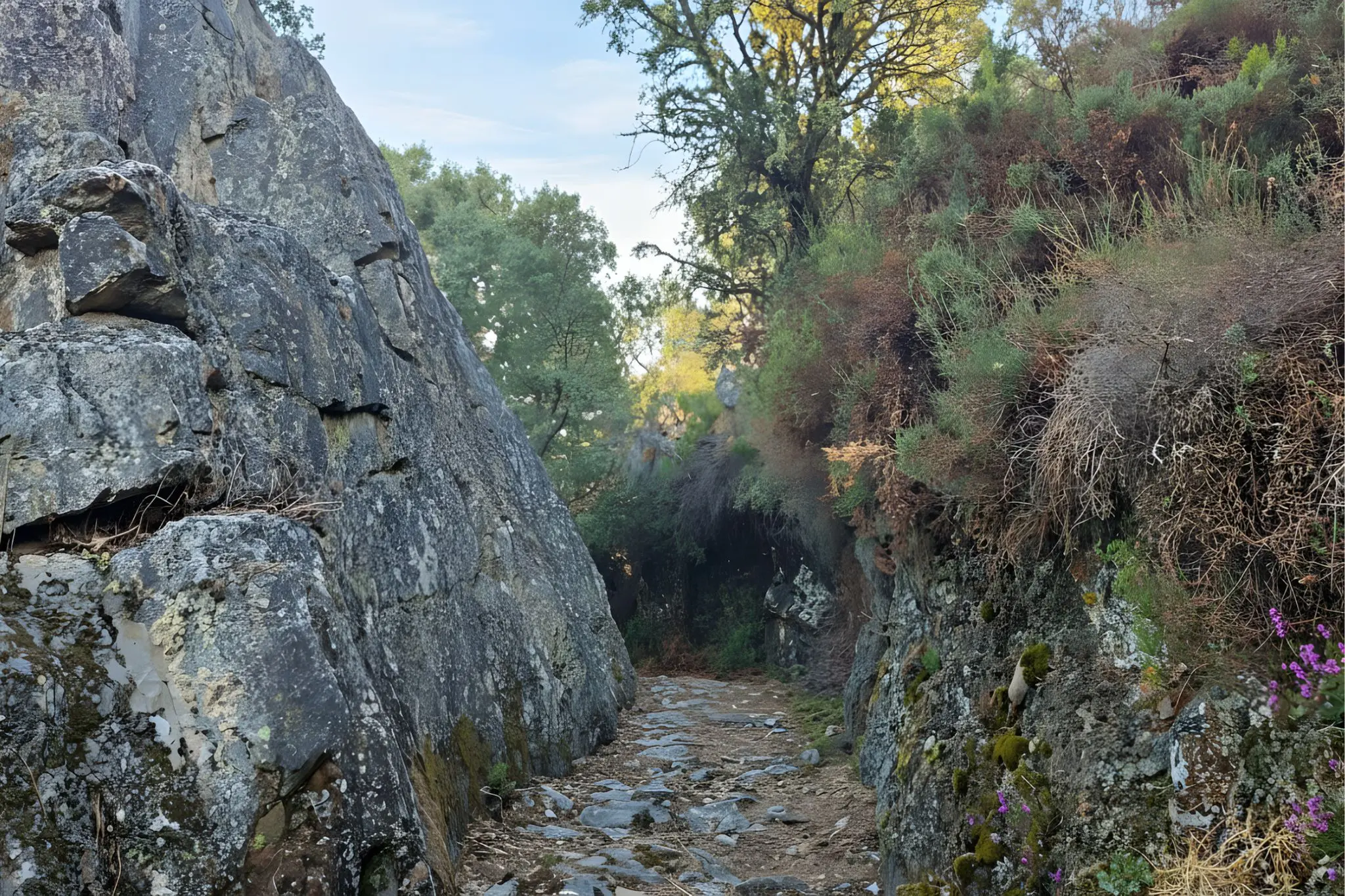
From Torbeo the path turns down toward the canyon, and the route’s quiet centrepiece arrives: Pena Tallada, the cut stone. Someone — men with picks and a great deal of patience — carved a passage straight through the rock so that carts, animals and goods could descend to the river. You walk through the gap they made. It is the kind of labour that does not survive as monument but as inconvenience removed, and feeling the chisel marks at shoulder height tells you more about this valley than any viewpoint will. A few steps on, a natural ledge gives the meander its first full reveal.
Then A Cubela itself, the hamlet that lends the meander its name. Here the gold becomes specific. The Romans worked these deposits with ruina montium — the same hydraulic violence that hollowed Las Médulas — driving tunnels into the slope, flooding them, and collapsing the ground to wash the debris for metal. The valley you are standing in was, in the second century, a worksite on an imperial scale. What remains is softer now: cork oaks where the channels ran, a few houses, the river going about its business below.
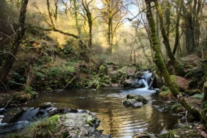
The final five kilometres are the reason locals rate this among the best walks in the Lugo Ribeira Sacra, and they are right. The path runs upstream along the Sil at water level, cobbled in long stretches and cut directly into the slate in others, shaded by a forest that has no business this far inland — cork oak, holm oak, the strawberry-tree madroño, a Mediterranean cast surviving in a pocket of warm microclimate. Roughly half the loop falls within the Rede Natura Ancares-Courel protected area, and this riverside stretch is where you understand why. A last gentle climb returns you to Castro de Abaixo, closing the circle.
Go in spring or autumn; the south-facing slopes turn the August climb punishing, and the river path, glorious in chestnut-leaf October, can be slick after rain on the cobbles and rock. The trail is signposted as PR-G 180 and was recently cleared, but conditions on the carved descent and the cobbled riverbank reward a stick and unhurried feet over speed. There is nothing at Castro de Abaixo but the start; carry what you need for the day, and treat Ribas de Sil or Quiroga as your nearest point for coffee and a roof. The Wikiloc track is worth loading before you lose signal in the canyon — the meander, for all its fame, is not where you would expect to lose your way; the soutos above Torbeo are.